
Leighton Buzzard
Andrews' Bedfordshire c1809, Map section
Places > Leighton Buzzard > Maps > Andrews'
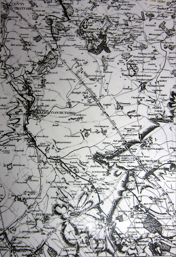
Section of, 'A map of the Country Sixty Five Miles, Round London, from Actual Surveys' by John Andrews and Andrew Dury.
Showing; Leighton Buzzard, Dunstable, Woburn, Ivinghoe and Watling Street
Scale 1:73000
Page last updated: 3rd February 2014