Bedfordshire
General History
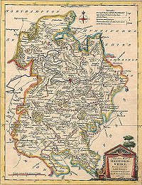
Bedfordshire 1776
Places > Bedfordshire > General History
Bedfordshire 1776

To see an enlarged version of this map (very large file) click here.
A Modern Map of Bedfordshire
drawn from the latest surveys; corrected and improved by the best
Authorities J. Ellis sculpt.
Printed for Carrington Bowles in St. Pauls Churchyard & Rob
Sayer in Fleet Street
Page last updated: 3rd February 2014
