Leighton Buzzard
Maps
Places > Leighton Buzzard > Maps > c1848
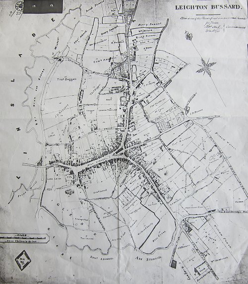
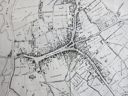
Leighton Bussard Town c1848 zoomed


Commissioned by J Tween, T Hart and J King. The map shows land owners and carries the words, 'This is one of the plans referred to in the annual award'
Scale: 3 Chains to the inch
Page last updated: 3rd February 2014
